
You are using an out of date browser. It may not display this or other websites correctly.
You should upgrade or use an alternative browser.
You should upgrade or use an alternative browser.
pfm Picture A Week (PAW) 2021
- Thread starter Gromit
- Start date
- Status
- Not open for further replies.
 Untitled
 Untitled
Mr Perceptive
Perceptive Member

Whitworth Flour Mill by David Yeoman, on Flickr
Last edited:
Mr Perceptive
Perceptive Member

Media City by David Yeoman, on Flickr
Rockmeister
pfm Member
 The Lady of Shalott by John Dutfield, on Flickr
miktec
retired
Just off the main road into Winster is this shed - a thin field stretching out behind it to the trees in the distance.
Together they formed a ropewalk, supplying the lead miners with the means to descend the shafts ...

Winster: ropewalk by mik tec, on Flickr
This OS map from 1899 shows the extent of the mines that had been exploited, and abandoned, by then - many of the pockmarks still clearly visible on contemporary satellite imagery:
https://maps.nls.uk/geo/explore/print/#zoom=17&lat=53.13847&lon=-1.64220&layers=168&b=1
Together they formed a ropewalk, supplying the lead miners with the means to descend the shafts ...
Winster: ropewalk by mik tec, on Flickr
This OS map from 1899 shows the extent of the mines that had been exploited, and abandoned, by then - many of the pockmarks still clearly visible on contemporary satellite imagery:
https://maps.nls.uk/geo/explore/print/#zoom=17&lat=53.13847&lon=-1.64220&layers=168&b=1
Last edited:
A previously un-shared image from winter just gone:

The Watering Hole by Amar Sood, on Flickr
Nikon Z7 / Nikkor 70-300mm f4.5-5.6 AF-P
Lefty
The Watering Hole by Amar Sood, on Flickr
Nikon Z7 / Nikkor 70-300mm f4.5-5.6 AF-P
Lefty
Gromit
Plasticine Dog
 Peg light
vince rocker
pfm Member
Scans of old medium format slides that I pulled out of "the archives" (a box) the other day. These are all Mamiya C330f with 80mm lens, Velvia 50, taken around 1995.
These two are I think Leverburgh harbour on Harris. Those colours can only be Velvia!
 leverburgh_harbour_2 by Tim, on Flickr
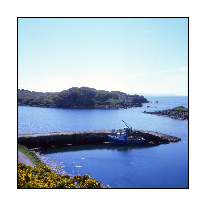 leverburgh_harbour by Tim, on Flickr
And these are Uig Sands.
 uig_sands_1 by Tim, on Flickr
 uig_sands_2 by Tim, on Flickr
These two are I think Leverburgh harbour on Harris. Those colours can only be Velvia!
leverburgh_harbour_2 by Tim, on Flickrleverburgh_harbour by Tim, on FlickrAnd these are Uig Sands.
uig_sands_1 by Tim, on Flickruig_sands_2 by Tim, on FlickrRockmeister
pfm Member
That first Uig sands is lovely. It’d make a great painting too!
eternumviti
Insufficient privileges to reply.
 The Tyne Low Tide 1986
I love this, suitably gritty.
ff1d1l
pfm Member

Bluebelly Hill by Mr ff1d1l, on Flickr
John Barry
pfm Member
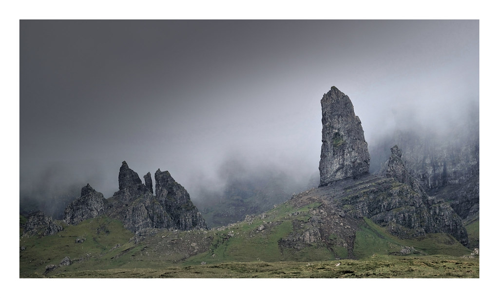
From here the Old Man of Storr is normally lost against the mountain backdrop. But the prevailing conditions gave a much better perspective on this occasion:
Fuji X-T30
Fuji X-T30
")
Gromit
Plasticine Dog
More digging through some old(er) images, all from Micro Four Thirds.
 Workhouse window by Boxertrixter, on Flickr
OM-D E-M1/Panasonic 20-1.7
Workhouse window by Boxertrixter, on FlickrOM-D E-M1/Panasonic 20-1.7
miktec
retired

ff1d1l
pfm Member
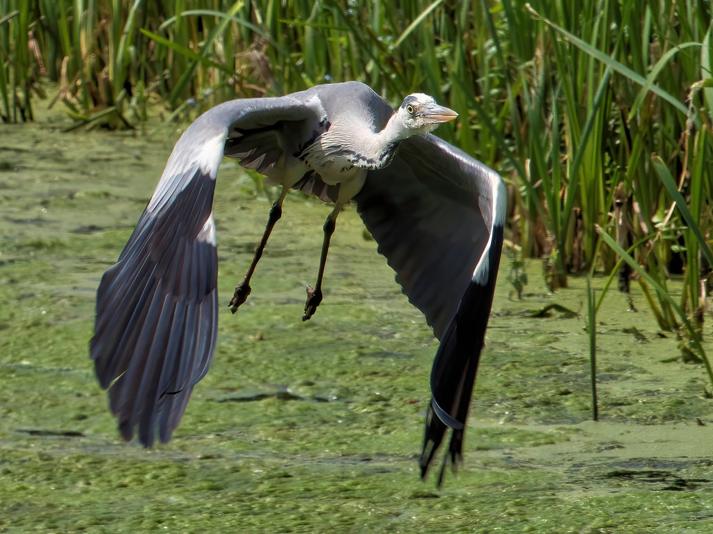
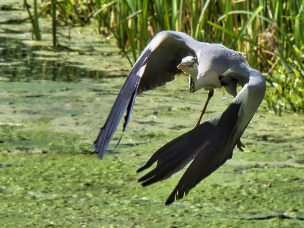
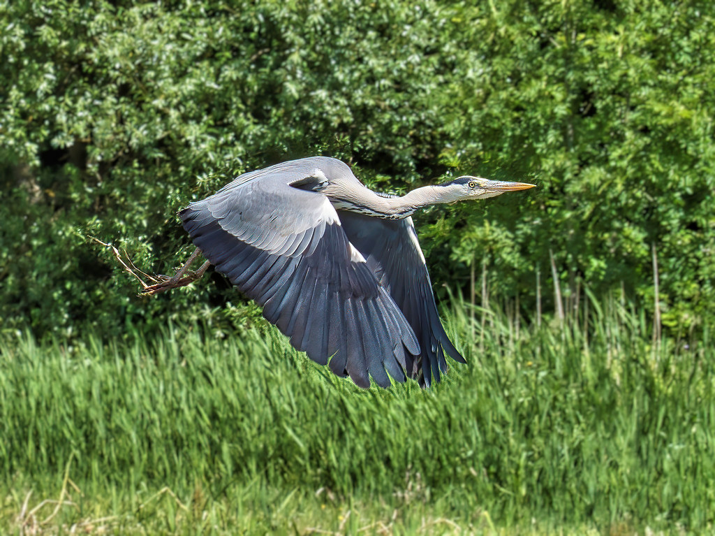
I was sitting with my son on the bridge at Penllyn last week, facing the lake, when one flew through the bridge arch right underneath us, emerging beneath our dangling legs...
Rockmeister
pfm Member
OMG. It’s the barrow downs!From here the Old Man of Storr is normally lost against the mountain backdrop. But the prevailing conditions gave a much better perspective on this occasion:
Fuji X-T30
Gromit
Plasticine Dog
Tea time at the workhouse:
 Work House by Boxertrixter, on Flickr
Olympus OM-D E-M1/Oly 12-40 2.8 Pro
Work House by Boxertrixter, on FlickrOlympus OM-D E-M1/Oly 12-40 2.8 Pro
- Status
- Not open for further replies.