
You are using an out of date browser. It may not display this or other websites correctly.
You should upgrade or use an alternative browser.
You should upgrade or use an alternative browser.
Industrial Decline
- Thread starter Mr Perceptive
- Start date
Mr Perceptive
Perceptive Member
I'll kick this off
The former David Rollo Marine Engineering Works, Regent Road, Liverpool. Founded by David Rollo 1877, superceeded by his sons (George and Malcolm) and then Georges son (also called George), the business amalgamated into H.C Grayson (Ship Repairers, Engineers and Dry Dock Proprieters). Eventually the business was integrated into Cammell, Laird & Co (Birkenhead).

David Rollo Marine Engineering by David Yeoman, on Flickr

David Rollo Rear of Building by David Yeoman, on Flickr
Images taken in Jan 2022
The former David Rollo Marine Engineering Works, Regent Road, Liverpool. Founded by David Rollo 1877, superceeded by his sons (George and Malcolm) and then Georges son (also called George), the business amalgamated into H.C Grayson (Ship Repairers, Engineers and Dry Dock Proprieters). Eventually the business was integrated into Cammell, Laird & Co (Birkenhead).
David Rollo Marine Engineering by David Yeoman, on Flickr
David Rollo Rear of Building by David Yeoman, on Flickr
Images taken in Jan 2022
Somafunk
pfm Member
Mate has a website catering to such a thing, he explores shuttered and derelict industrial complexes whilst capturing them through his photography
http://catchingphotons.co.uk/blog/
http://catchingphotons.co.uk/blog/
Mr Perceptive
Perceptive Member
Tube Alloys at Rhydymwyn Valley Works
The Ministry Of Supply Factory at Rhydymwyn was built in WW2 as a chemical weapons site (production and storage or Mustard Gas). Additional buildings were built on the site as part of the secret British "Tube Alloys" project (early nuclear weapons research and development). This project was later moved to the USA and integrated into the Manhattan project. The equipment on this site was then moved to Harwell (Oxfordshire). The site (and the storage tunnels) were then used for the storage of Cold War Weapons until 1994.
Images taken on a permission visit in 2015

Tube Alloys - Rhydymwyn Valley Works-2 by David Yeoman, on Flickr

Tube Alloys - Rhydymwyn Valley Works-1 by David Yeoman, on Flickr

Tube Alloys - Rhydymwyn Valley Works-3 by David Yeoman, on Flickr
The Ministry Of Supply Factory at Rhydymwyn was built in WW2 as a chemical weapons site (production and storage or Mustard Gas). Additional buildings were built on the site as part of the secret British "Tube Alloys" project (early nuclear weapons research and development). This project was later moved to the USA and integrated into the Manhattan project. The equipment on this site was then moved to Harwell (Oxfordshire). The site (and the storage tunnels) were then used for the storage of Cold War Weapons until 1994.
Images taken on a permission visit in 2015
Tube Alloys - Rhydymwyn Valley Works-2 by David Yeoman, on Flickr
Tube Alloys - Rhydymwyn Valley Works-1 by David Yeoman, on Flickr
Tube Alloys - Rhydymwyn Valley Works-3 by David Yeoman, on Flickr
eternumviti
Insufficient privileges to reply.
Excellent.
ian123running
pfm Member
Fantastic idea for a thread. Here's an phone picture from our bike tour across France last summer - really monumental almost shocking 'wall' enclosing a series of factories / warehouses in the small town of Génelard, Bourgogne-Franche-Compté. The workshops were built to serve the mining industry. This wall was built around 1949, probably designed earlier but I guess interrupted by the war. It's right next to the Canal du Centre. We'd had a few hours cycling along the canal in rural tranquility to be met with this imposing and stylish decaying structure, quite out of the blue. Nice typeface eh?
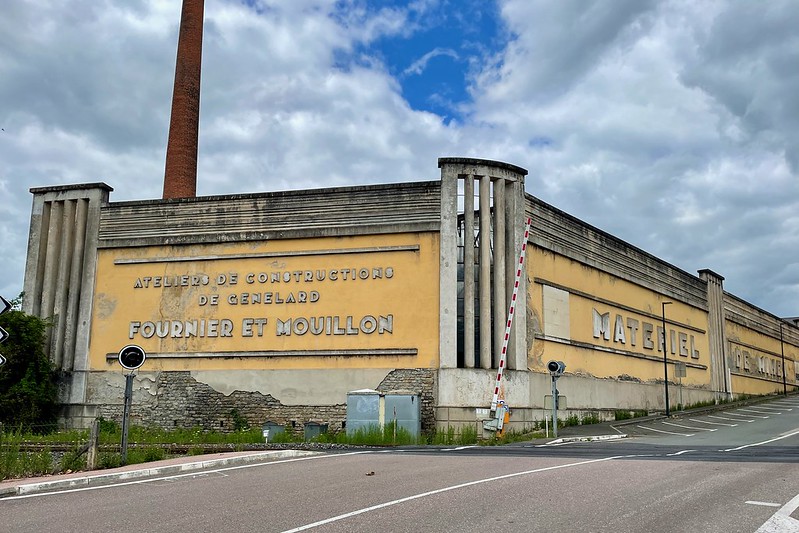 IMG_7778 by Ian Meadowcroft, on Flickr
IMG_7778 by Ian Meadowcroft, on Flickr
Last edited:
ff1d1l
pfm Member
Rhiwbach Tramway
A view down onto the country the Tramway goes through - left of centre is the top of the incline system going down to Blaenau Ffestiniog, and the tramway can by followed back to Bowydd Lake, just peeping out from behind the crag to the right of centre.

Go The Distance by Mr ff1d1l, on Flickr

Rhiwbach Tramway & Cwt Y Bugail by Mr ff1d1l, on Flickr

Llyn Bowydd by Mr ff1d1l, on Flickr
The Rhiwbach Tramway was built by Owen Gethin Jones, under contract, to serve a number of elevated quarries on high moorland

Precarious by Mr ff1d1l, on Flickr
and follows a roughly 1600 feet above sea level contour for about 7 kilometers. An incline system ran down to Blaenau Ffestiniog, where there was a rail connection.

Down Dog by Mr ff1d1l, on Flickr

All Downhill From Here by Mr ff1d1l, on Flickr
It was completed in 1863 and ran for a century, the rails being lifted in 1964. The quarry which it served furthest from Blaenau, Manod, housed the art from the National Gallery during the second world war, in pioneering climate controlled brick buildings in the underground caverns. Most inclines were gravity driven, including the system from the tramway down into Blaenau, but there was also a connection to the tramway from Rhiwbach Quarry, via a steam driven incline. What's left of the engine looks like this, and in this winter shot the remoteness and terrible weather which lead to the eventual abandonment of the village in which workers lived can be appreciated.

One Step Into the Clouds by Mr ff1d1l, on Flickr
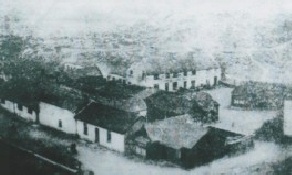
Rhiwbach village was sufficiently remote to have a school, a shop, and a purpose-built reading room building for social, recreational and religious use. Several children were born in the village.

Once A Village by Mr ff1d1l, on Flickr
And as was - the only surviving image of the Rhiwbach Village
The Rhiwbach Tramway is one of my favorite locations to take a camera - I always come back with something new from the scattered old.
A view down onto the country the Tramway goes through - left of centre is the top of the incline system going down to Blaenau Ffestiniog, and the tramway can by followed back to Bowydd Lake, just peeping out from behind the crag to the right of centre.
Go The Distance by Mr ff1d1l, on Flickr
Rhiwbach Tramway & Cwt Y Bugail by Mr ff1d1l, on Flickr
Llyn Bowydd by Mr ff1d1l, on Flickr
The Rhiwbach Tramway was built by Owen Gethin Jones, under contract, to serve a number of elevated quarries on high moorland
Precarious by Mr ff1d1l, on Flickr
and follows a roughly 1600 feet above sea level contour for about 7 kilometers. An incline system ran down to Blaenau Ffestiniog, where there was a rail connection.
Down Dog by Mr ff1d1l, on Flickr
All Downhill From Here by Mr ff1d1l, on Flickr
It was completed in 1863 and ran for a century, the rails being lifted in 1964. The quarry which it served furthest from Blaenau, Manod, housed the art from the National Gallery during the second world war, in pioneering climate controlled brick buildings in the underground caverns. Most inclines were gravity driven, including the system from the tramway down into Blaenau, but there was also a connection to the tramway from Rhiwbach Quarry, via a steam driven incline. What's left of the engine looks like this, and in this winter shot the remoteness and terrible weather which lead to the eventual abandonment of the village in which workers lived can be appreciated.
One Step Into the Clouds by Mr ff1d1l, on Flickr
Rhiwbach village was sufficiently remote to have a school, a shop, and a purpose-built reading room building for social, recreational and religious use. Several children were born in the village.
Once A Village by Mr ff1d1l, on Flickr
And as was - the only surviving image of the Rhiwbach Village
The Rhiwbach Tramway is one of my favorite locations to take a camera - I always come back with something new from the scattered old.
Last edited:
eternumviti
Insufficient privileges to reply.
Fabulous photographs. The sense of both scale and remoteness is impressive, and they are so atmospheric.
Mr Perceptive
Perceptive Member
Continuing at Rhydymwyn Valley Works
From Wikipedia
The site occupies around 35 hectares of the Alyn Valley, to the south of the village of Rhydymwyn (centred on SJ 205 668). Once part of the extensive Gwysaney Estate, the Parish of Rhydymwyn was established in 1865. Lead mining in the area is known to have been extensive, and a foundry associated with nearby mines is depicted on several early maps for the area. Following the closure of the foundry land use on the site was largely agricultural in character. However, in 1939 the land was purchased by the Ministry of Supply and developed as a purpose built chemical weapons factory and storage facility.
Over 100 specialised buildings were constructed across the site, linked by an extensive rail network established around a spur off the Chester to Denbigh mainline. Other major landscaping undertaken at this time included the canalisation and culverting of the River Alyn, and the excavation of a complex of interlinked subterranean, rock-cut tunnels and caverns. During World War II the plant produced ordnance containing mustard gas, and was associated with the development of the Atom Bomb. In the immediate Post-War period the site was used to store German nerve gas, and it was not until the 1950s when Britain relinquished its chemical weapons (CW) capability that the site as a chemical storage facility was defunct. However, the site remains on the international Chemical Weapons List, and is still monitored as such.
From the mid-1960s the site was used by various governmental departments, its major function being a buffer storage depot to supply emergency rations and foodstuffs, and associated facilities such as mobile bakeries and canteens. In 1994 the site was closed, and a programme of demolition was undertaken. This involved the dropping of buildings onto their footprints, and the rubble being mounded over with topsoil. Several major structures, and many ancillary buildings, still survive across the site.
The surviving buildings are a reminder of a huge building programme that changed the face of Britain forever and the site remains as unique today as it was at its inception
Images taken on a permission visit in 2015

Rhydymwyn Valley Works 1 by David Yeoman, on Flickr

Rhydymwyn Valley Works 2 by David Yeoman, on Flickr

Rhydymwyn Valley Works 3 by David Yeoman, on Flickr

Rhydymwyn Valley Works 5 by David Yeoman, on Flickr

Rhydymwyn Valley Works 6 by David Yeoman, on Flickr
From Wikipedia
The site occupies around 35 hectares of the Alyn Valley, to the south of the village of Rhydymwyn (centred on SJ 205 668). Once part of the extensive Gwysaney Estate, the Parish of Rhydymwyn was established in 1865. Lead mining in the area is known to have been extensive, and a foundry associated with nearby mines is depicted on several early maps for the area. Following the closure of the foundry land use on the site was largely agricultural in character. However, in 1939 the land was purchased by the Ministry of Supply and developed as a purpose built chemical weapons factory and storage facility.
Over 100 specialised buildings were constructed across the site, linked by an extensive rail network established around a spur off the Chester to Denbigh mainline. Other major landscaping undertaken at this time included the canalisation and culverting of the River Alyn, and the excavation of a complex of interlinked subterranean, rock-cut tunnels and caverns. During World War II the plant produced ordnance containing mustard gas, and was associated with the development of the Atom Bomb. In the immediate Post-War period the site was used to store German nerve gas, and it was not until the 1950s when Britain relinquished its chemical weapons (CW) capability that the site as a chemical storage facility was defunct. However, the site remains on the international Chemical Weapons List, and is still monitored as such.
From the mid-1960s the site was used by various governmental departments, its major function being a buffer storage depot to supply emergency rations and foodstuffs, and associated facilities such as mobile bakeries and canteens. In 1994 the site was closed, and a programme of demolition was undertaken. This involved the dropping of buildings onto their footprints, and the rubble being mounded over with topsoil. Several major structures, and many ancillary buildings, still survive across the site.
The surviving buildings are a reminder of a huge building programme that changed the face of Britain forever and the site remains as unique today as it was at its inception
Images taken on a permission visit in 2015
Rhydymwyn Valley Works 1 by David Yeoman, on Flickr
Rhydymwyn Valley Works 2 by David Yeoman, on Flickr
Rhydymwyn Valley Works 3 by David Yeoman, on Flickr
Rhydymwyn Valley Works 5 by David Yeoman, on Flickr
Rhydymwyn Valley Works 6 by David Yeoman, on Flickr
Mr Perceptive
Perceptive Member
The station with its rubberised platform covering
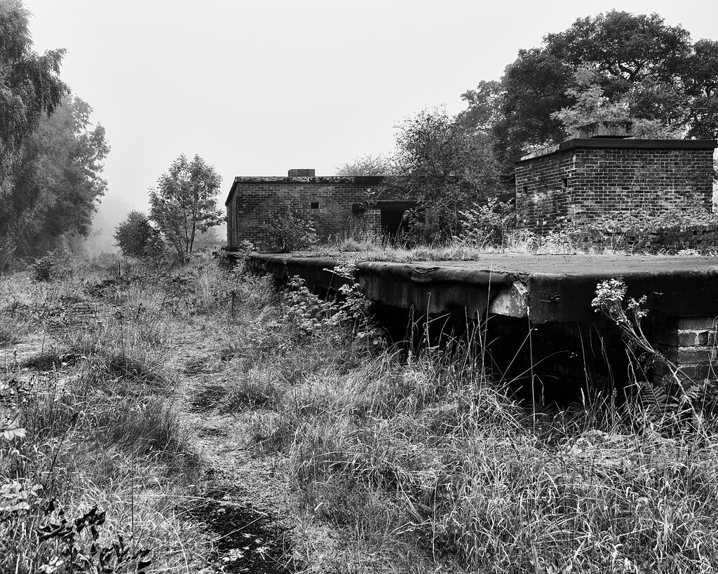
Station - Rhydymwyn Valley Works by David Yeoman, on Flickr
Wall Art!
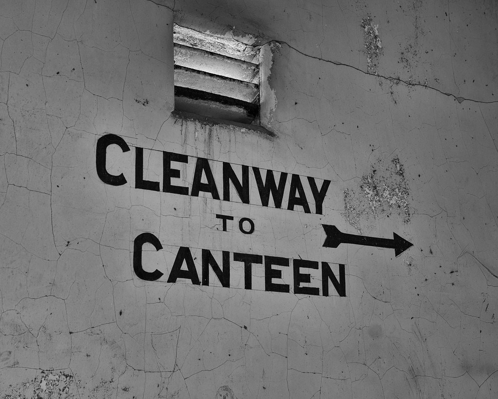
Cleanway - Rhydymwyn Valley Works by David Yeoman, on Flickr

Calculations - Rhydymwyn Valley Works by David Yeoman, on Flickr
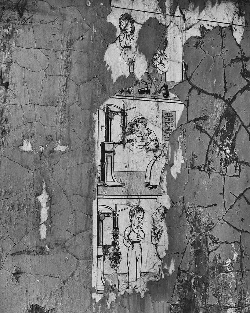
Keep Your Eye On The Job - Rhydymwyn Valley Works by David Yeoman, on Flickr
Station - Rhydymwyn Valley Works by David Yeoman, on Flickr
Wall Art!
Cleanway - Rhydymwyn Valley Works by David Yeoman, on Flickr
Calculations - Rhydymwyn Valley Works by David Yeoman, on Flickr
Keep Your Eye On The Job - Rhydymwyn Valley Works by David Yeoman, on Flickr
ff1d1l
pfm Member
Fantastic ephemeral finds there!The station with its rubberised platform covering
Station - Rhydymwyn Valley Works by David Yeoman, on Flickr
Wall Art!
Cleanway - Rhydymwyn Valley Works by David Yeoman, on Flickr
Calculations - Rhydymwyn Valley Works by David Yeoman, on Flickr
Keep Your Eye On The Job - Rhydymwyn Valley Works by David Yeoman, on Flickr
Last edited:
daytona600
Registered User
Myself , Father & Grandfather & 10,000 others
1954 The Ravenscraig plant had one of the longest continuous casting, hot rolling, steel production facilities in the world before it was decommissioned. Construction of the integrated iron and steel works started in 1954. In 1992, when it closed down, it was the largest hot strip steel mill in Western Europe.
.
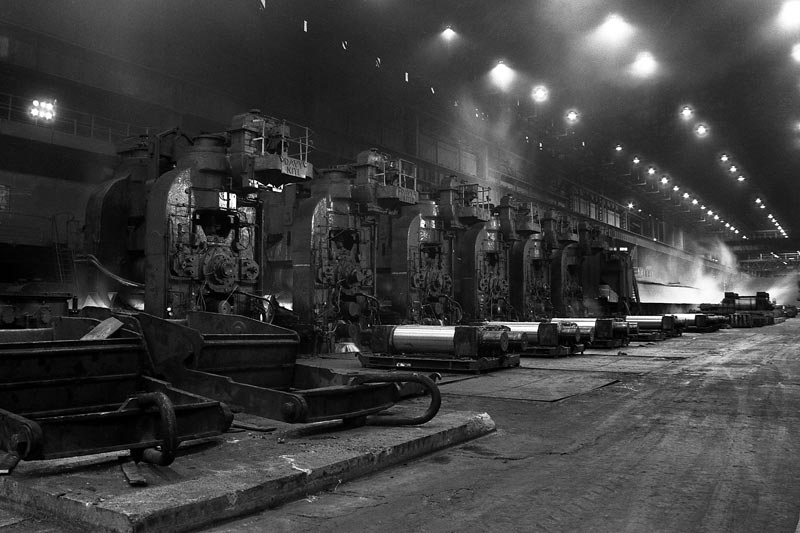

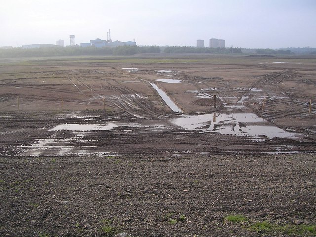
2006 Derelict site of the Ravenscraig Works, looking towards the remaining Dalzell Works
-
1954 The Ravenscraig plant had one of the longest continuous casting, hot rolling, steel production facilities in the world before it was decommissioned. Construction of the integrated iron and steel works started in 1954. In 1992, when it closed down, it was the largest hot strip steel mill in Western Europe.
.
2006 Derelict site of the Ravenscraig Works, looking towards the remaining Dalzell Works
-
eternumviti
Insufficient privileges to reply.
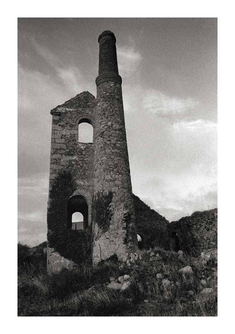
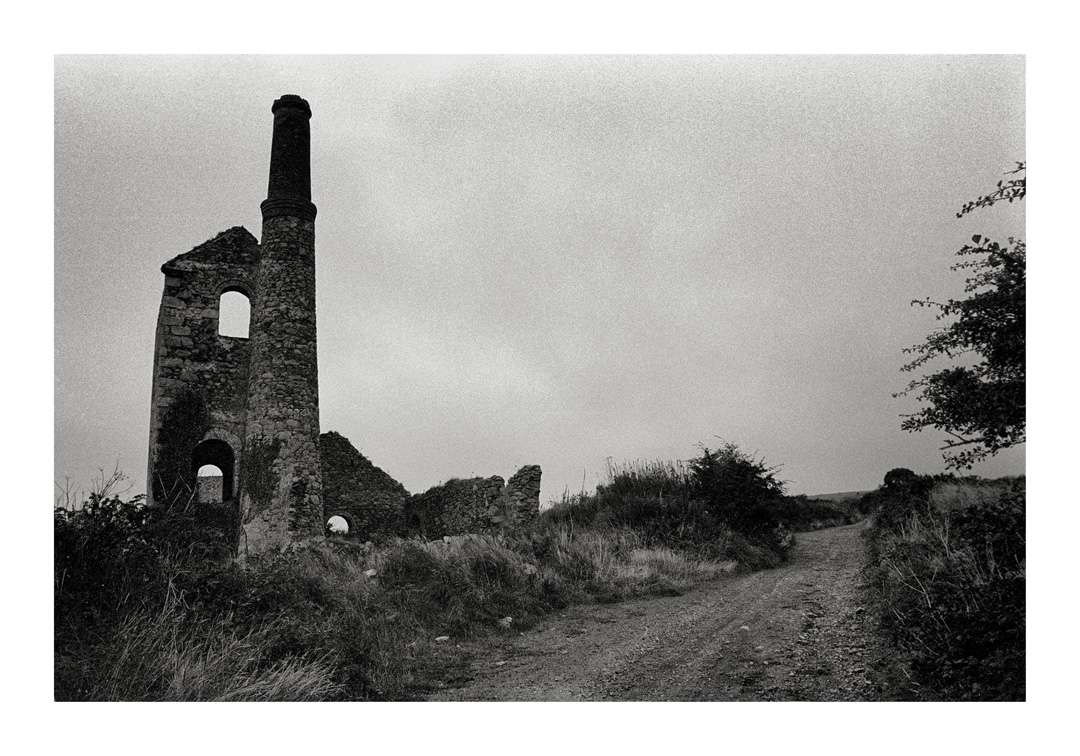
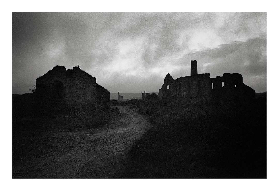
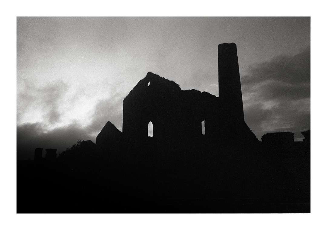
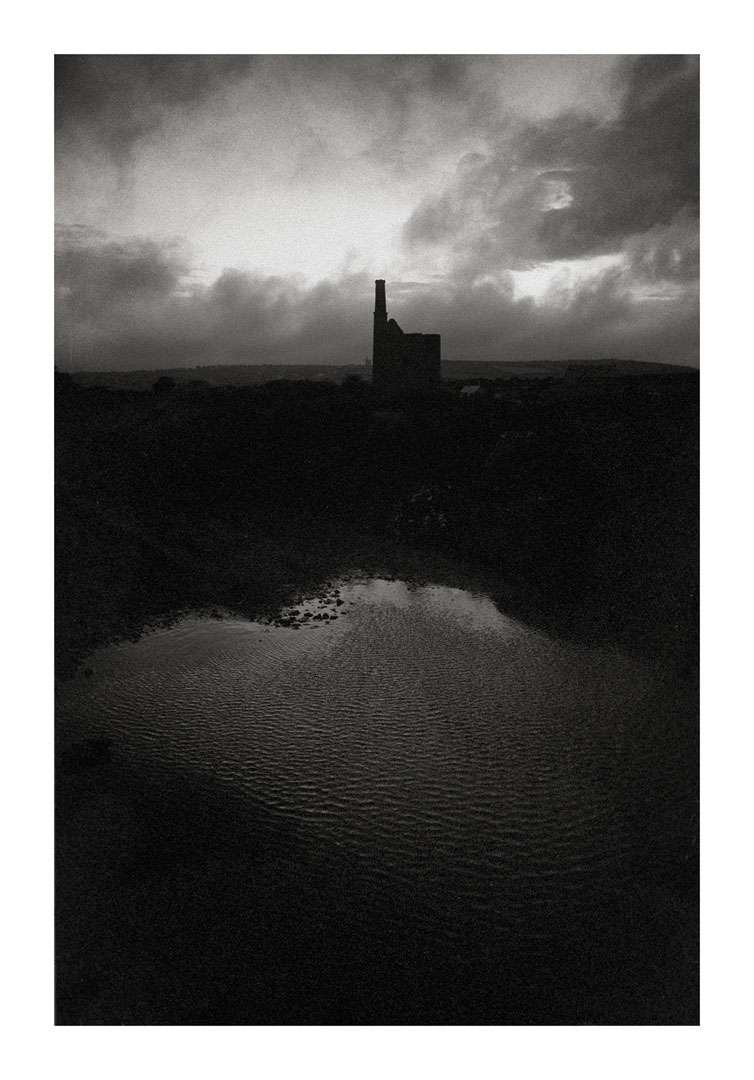
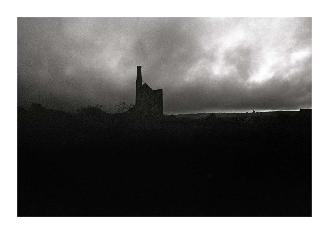
South Wheal Bassett Mine, Cornwall
An amalgamation of three copper mines to the east of Carn Brae and Redruth, which took place in 1896, when the workings hit the 'Great Flat Lode', a rich tin-bearing lode named for its shallow angle. The surface workings were centred around three shafts, Pacoe's, Thomas's and Marriott's, which incorporated the earlier South Wheal Frances site. The Marriott's buildings, opened in 1896 following the amalgamation, are both impressive and unique, being clearly influenced by the design of the Methodist chapels that are found across Cornwall. Thomas's pumping house dates back to the 1850s, and doesn't appear in any of the photos - I never actually found it.
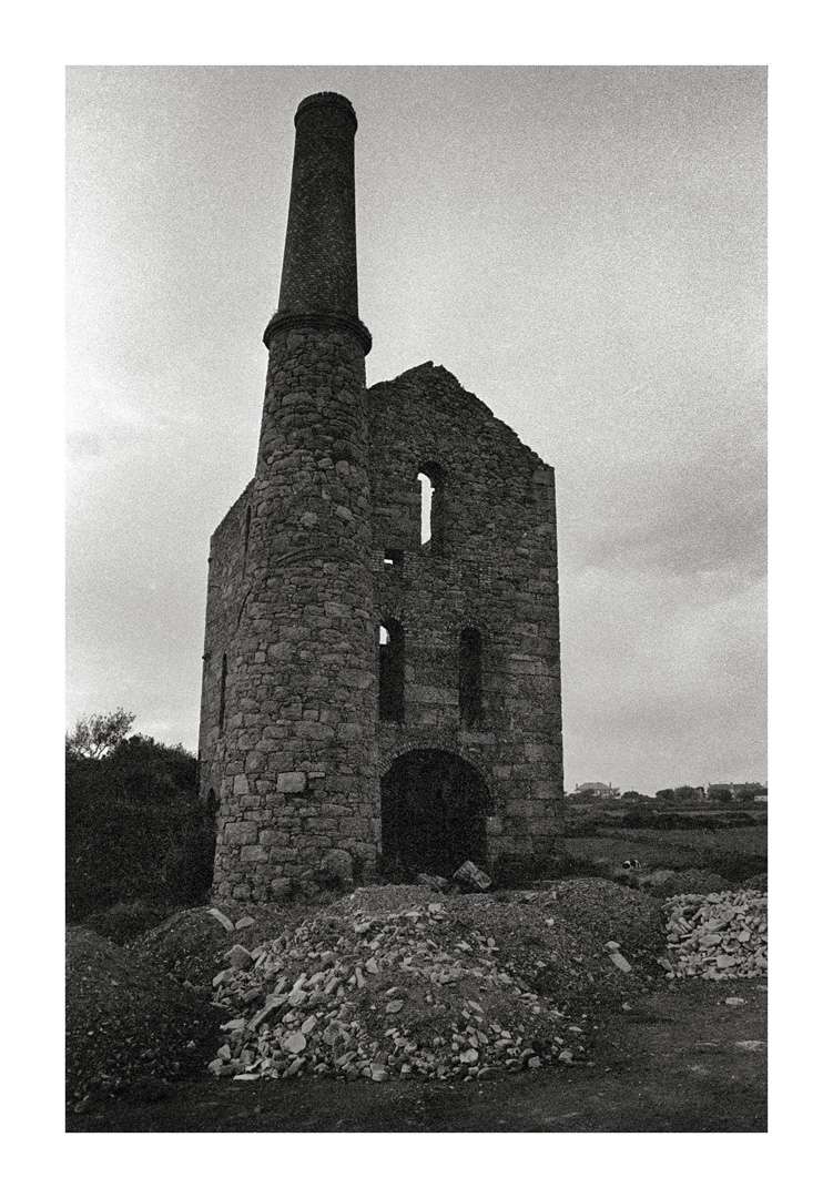
The bulk of these photos were taken in 1980 using my Pentax ES and a Tamron Adaptall zoom. The stock is HP5, probably developed in D76/ID11. The site then had a distinct air of abandonment and neglect, for it was before the old tin mines had become part of Cornwall's visitable heritage. Camborne and Redruth were both in a deep post-industrial state of depression, and there was simply no interest. All three shafts were then still open, and hazardous. I walked across the ruins on what had started out as a pleasant evening, but which rapidly degenerated into a bitter squall, which brought with it an unexpectedly early onset of darkness. The atmosphere was threatening, and as I retreated back to my car there was a sense that I might suddenly pitch into some previously unseen and hideous abyss.
Pascoe's Shaft Whim & boiler house, and the track up to Marriott's. The first and last were taken in 1980, the second 34 years later.
Pascoe's Shaft Pumping Engine, which worked from 1881 to 1918. The design, with the narrow windows, is unsual.
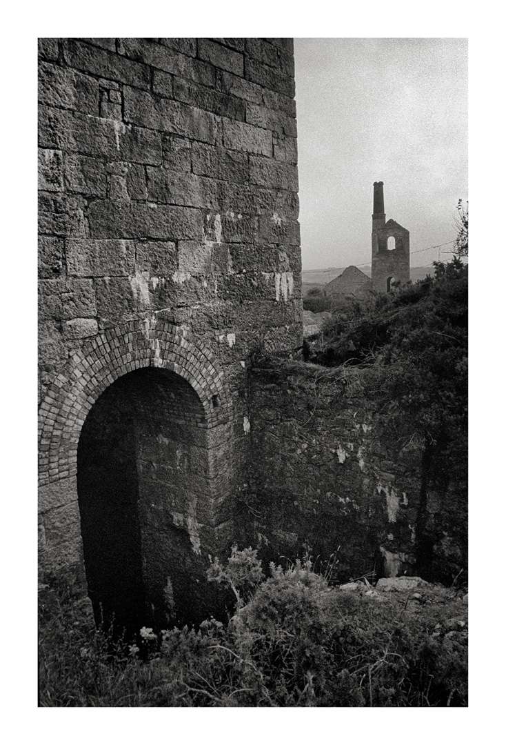
Looking across the open shaft to the whim. The latter would have wound men and ore using the headgear over this shaft.
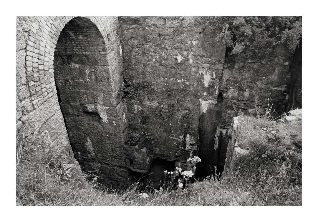
As close as I dared crawl. The only barrier was a few strands of barbed wire, but once crossed this vertigo sufferer felt precariously, head-spinningly trapped between the wire and the abyss. I was relieved to escape. The shaft pumped to a depth of 340 fathoms. The shaft is now capped, and the building thus emasculated, the arch exposed to the 'Great Flat Trail', and this upper structure of the shaft lopped away.
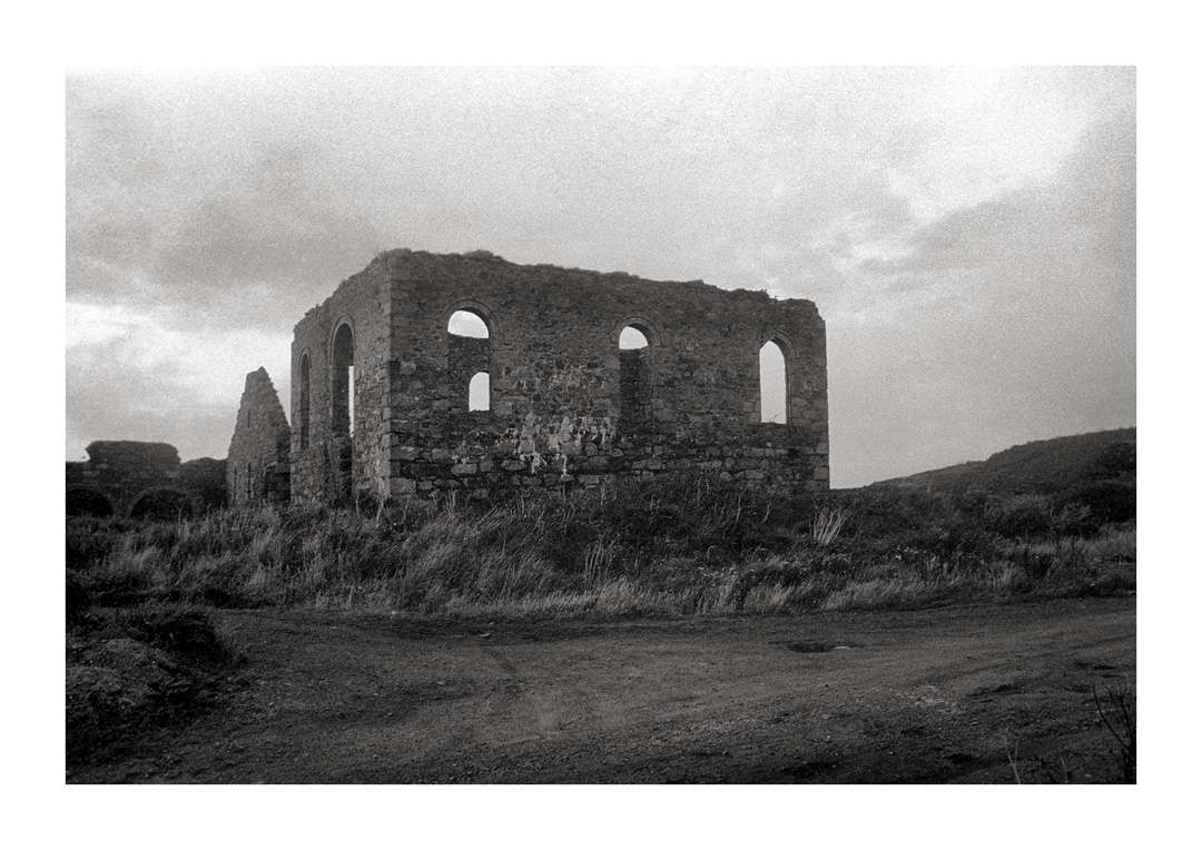
Marriot's Pumping Engine house, 1980, the impressive boiler house which housed six Lancashire boilers beyond. The winding engine was a horizontal engine made by Holman Bros, and could wind at 2000ft per minute.
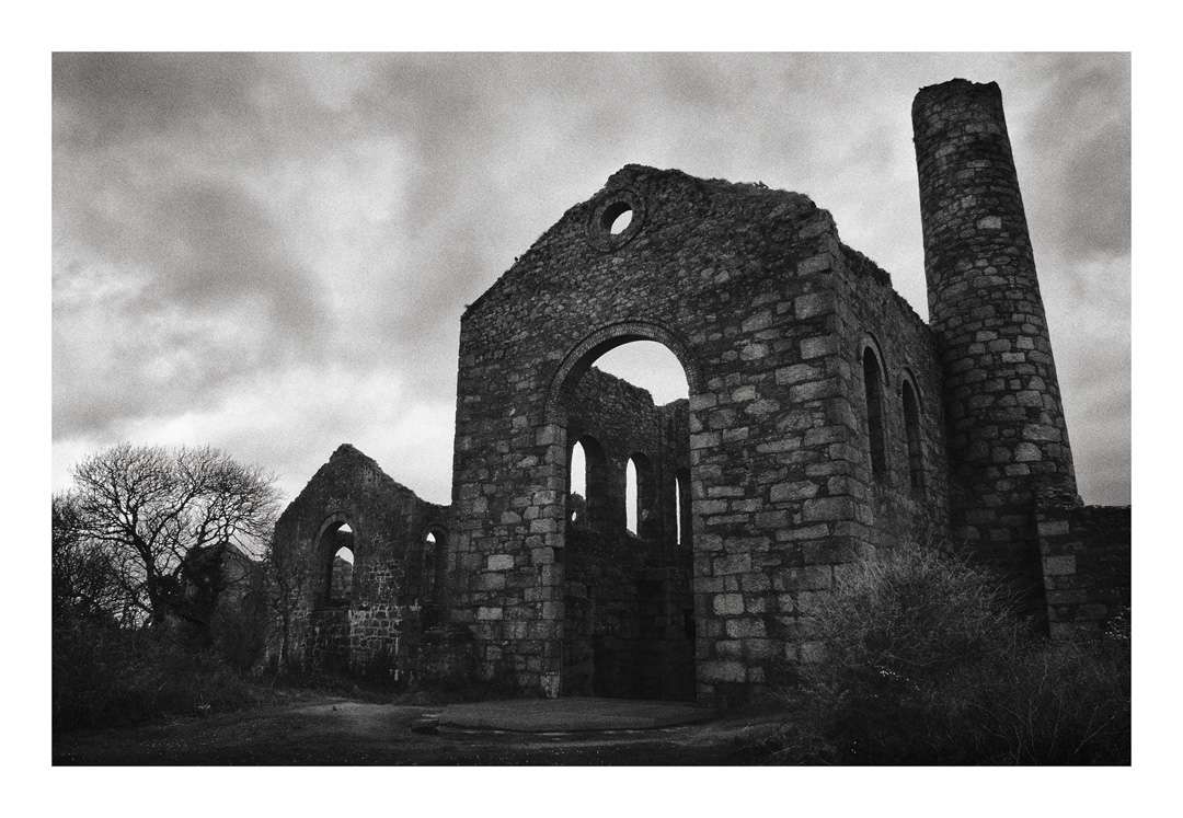
Marriott's Pumping Engine taken in 2014, with the grill-covered shaft, which I believe has since been capped, in front of it. Next to the main building is the Compressor House, which powered the rock drills deep down in the mine, and beyond it the Ore Hopper.
The then still open shaft in 1980. 14' wide, cylindrical and brick lined, it ran to a depth of 370 fathoms. Looking down it was utterly terrifying, despite lying flat on my belly. Visible beyond is Pascoe's Pump, and in the far distance one of the engine houses on the Condurrow Sett. The weather was now rapidly closing in.
An amalgamation of three copper mines to the east of Carn Brae and Redruth, which took place in 1896, when the workings hit the 'Great Flat Lode', a rich tin-bearing lode named for its shallow angle. The surface workings were centred around three shafts, Pacoe's, Thomas's and Marriott's, which incorporated the earlier South Wheal Frances site. The Marriott's buildings, opened in 1896 following the amalgamation, are both impressive and unique, being clearly influenced by the design of the Methodist chapels that are found across Cornwall. Thomas's pumping house dates back to the 1850s, and doesn't appear in any of the photos - I never actually found it.
The bulk of these photos were taken in 1980 using my Pentax ES and a Tamron Adaptall zoom. The stock is HP5, probably developed in D76/ID11. The site then had a distinct air of abandonment and neglect, for it was before the old tin mines had become part of Cornwall's visitable heritage. Camborne and Redruth were both in a deep post-industrial state of depression, and there was simply no interest. All three shafts were then still open, and hazardous. I walked across the ruins on what had started out as a pleasant evening, but which rapidly degenerated into a bitter squall, which brought with it an unexpectedly early onset of darkness. The atmosphere was threatening, and as I retreated back to my car there was a sense that I might suddenly pitch into some previously unseen and hideous abyss.
Pascoe's Shaft Whim & boiler house, and the track up to Marriott's. The first and last were taken in 1980, the second 34 years later.
Pascoe's Shaft Pumping Engine, which worked from 1881 to 1918. The design, with the narrow windows, is unsual.
Looking across the open shaft to the whim. The latter would have wound men and ore using the headgear over this shaft.
As close as I dared crawl. The only barrier was a few strands of barbed wire, but once crossed this vertigo sufferer felt precariously, head-spinningly trapped between the wire and the abyss. I was relieved to escape. The shaft pumped to a depth of 340 fathoms. The shaft is now capped, and the building thus emasculated, the arch exposed to the 'Great Flat Trail', and this upper structure of the shaft lopped away.
Marriot's Pumping Engine house, 1980, the impressive boiler house which housed six Lancashire boilers beyond. The winding engine was a horizontal engine made by Holman Bros, and could wind at 2000ft per minute.
Marriott's Pumping Engine taken in 2014, with the grill-covered shaft, which I believe has since been capped, in front of it. Next to the main building is the Compressor House, which powered the rock drills deep down in the mine, and beyond it the Ore Hopper.
The then still open shaft in 1980. 14' wide, cylindrical and brick lined, it ran to a depth of 370 fathoms. Looking down it was utterly terrifying, despite lying flat on my belly. Visible beyond is Pascoe's Pump, and in the far distance one of the engine houses on the Condurrow Sett. The weather was now rapidly closing in.
eternumviti
Insufficient privileges to reply.
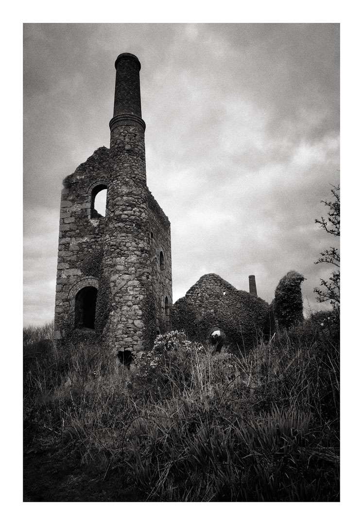
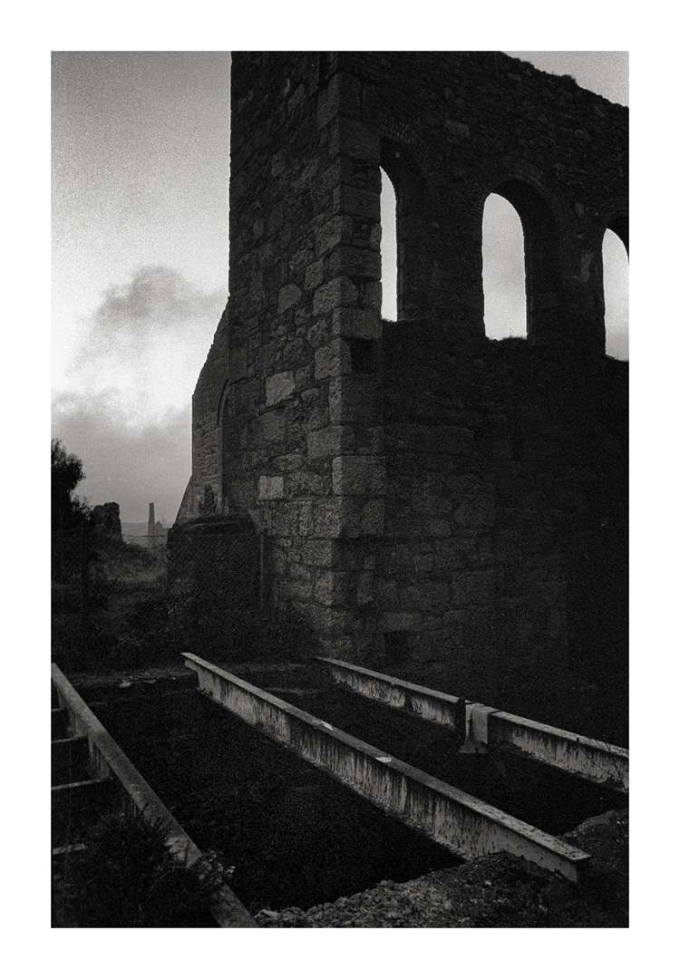
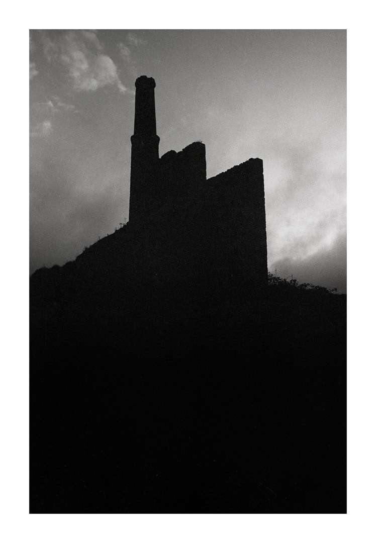
By the time I took the following photos as I walked back down the track, darkness was descending rapidly. I can't remember whether I was exposing for dramatic effect, or whether it was simply too dark to achieve presentable hand-held exposures. In those instances I used to set the shutter to 1/30th of a second and hope that I exposed something. Either way, in this instance it was the cloud-scudded sky that got the upper hand, leaving the ruins as somewhat sinister silhouettes.
ff1d1l
pfm Member
Excellent shots here, particularly like the later moody silhouettes!By the time I took the following photos as I walked back down the track, darkness was descending rapidly. I can't remember whether I was exposing for dramatic effect, or whether it was simply too dark to achieve presentable hand-held exposures. In those instances I used to set the shutter to 1/30th of a second and hope that I exposed something. Either way, in this instance it was the cloud-scudded sky that got the upper hand, leaving the ruins as somewhat sinister silhouettes.
eternumviti
Insufficient privileges to reply.
A friend of mine was a keen student of Cornwalls industrial history and has a wonderful collection of medium format images. He managed to end up on the county council payroll for 25 hrs in their archeology dept so really enjoyed going to work!
Dream job, the lucky bugger.
eternumviti
Insufficient privileges to reply.
Excellent shots here, particularly like the later moody silhouettes!
Thank you. They conformed I think to a photographic style that was quite popular back then, but as I said, whether intentional or accidental I can't remember!